


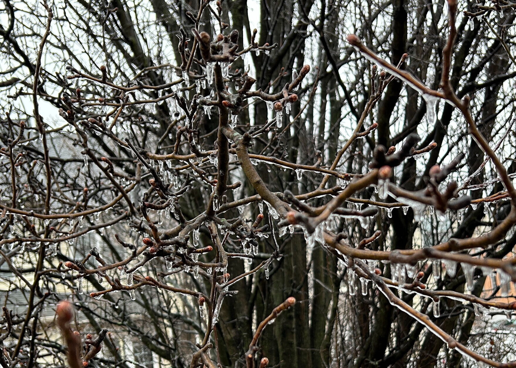
After a gloomy and cloudy Wednesday, parts of the region saw overnight sleet and freezing rain. The weather will turn to rain on Thursday morning, creating slick road conditions.
(WTOP/Jessica Kronzer)
WTOP/Jessica Kronzer
(WTOP/Neal Augenstein)
WTOP/Neal Augenstein

Freezing rain created a slippery morning commute for those driving to work in the D.C. area on Thursday as many other residents were faced with widespread power outages.
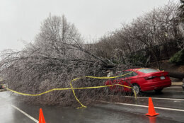
As the freezing rain sweeps through the region, thousands across the District, Maryland and Virginia were left without electricity.
Data released by Dominion Energy showed upwards of 20,000 customers in Virginia were without power as of around noon Thursday. By 4:30 p.m., that number had dropped to just under 5,000 customers.
The bulk of the outages in Northern Virginia were reported in Fairfax and Fauquier counties, according to the Dominion outage map.
“Dominion Energy continues to closely monitor freezing rain and its potential to impact our Virginia territory,” reads an alert issued by Dominion. “Our crews are actively working to assess damage and make repairs to restore power.”
It’s unclear how long it will take for emergency crews to restore power.
WTOP’s Neal Augenstein earlier reported that road crews were spotted spreading salt and reminded people that bridges, sidewalks and overpasses “are more likely to freeze first since the air temperatures beneath them could be below 32 degrees.”
“If your windshield wipers or defroster are working well, you should be in good shape” in most of the D.C. area,” Augenstein said.
A winter weather advisory for most of the D.C. region ended before 9:20 a.m., an hour earlier than expected. Meanwhile, an ice storm warning for far Western Maryland was canceled after 11 a.m.
Multiple D.C.-area school systems announced closings or delays due to the forecast. View the full list here.
“Most of the main thoroughfares have pavement temperatures of anywhere from 32 to 34 degrees, but when you go over those bridges and overpasses, it easily could be a sheet of ice,” WTOP Meteorologist Chad Merrill said.
He said fog was likely in the Blue Ridge and along the Potomac and Chesapeake Bay before the warm front pushes through around 11 a.m.
The rain is expected to end between noon and 3 p.m. with a “little bit of sunshine” and temperatures warming above freezing at around 40 degrees.
“We have to watch out for some dense fog developing just after sunset this evening, that will become a bit widespread tonight,” Merrill said.
As the wind kicks in, he said that fog will clear out overnight and into Friday morning.
Friday will be sunny but breezy with temperature highs nearing 50 degrees. But another wintry mix is possible for Saturday afternoon with chilly highs in the upper 30s.
FORECAST
THURSDAY: Sleet and freezing rain away from the Capital Beltway becoming all rain. Rain ending between noon-3 p.m. Light icing will make sidewalks/parking lots/bridges and overpasses slippery.
High: Around 40 degrees.
Winds: Light SE becoming SW
THURSDAY NIGHT: Clearing with fog. Refreezing of wet spots on sidewalks and parking lots far west of D.C.
Low: Mid 30s
Winds: Calm, becoming light NW
FRIDAY: Early sun, then partly sunny and breezy.
High: Low 50s
Winds: NW at 10-20 mph.
SATURDAY: Midday to afternoon light snow, freezing rain, sleet and rain mix. Best chance for ice and snow accumulation along and west of the Blue Ridge.
High: Mid to Upper 30s.
Winds: SE 5-10 mph.
SUNDAY: Partly to mostly cloudy and brisk.
High: Low 50s.
Winds: NW 15-25 mph.
Get breaking news and daily headlines delivered to your email inbox by signing up here.
© 2025 WTOP. All Rights Reserved. This website is not intended for users located within the European Economic Area.

